
Lewis & Clark National Historic Trail
Jefferson River Canoe Trail
Sustaining Our Montana Traditions
By Thomas J. Elpel
The Jefferson River Canoe Trail is a network of multipurpose backcountry campsites on private and public lands along the Jefferson River. The public may paddle into these sites for primitive camping along the river. At each camp there are opportunities for such activities as bird watching, mushrooming, hiking, and fishing.
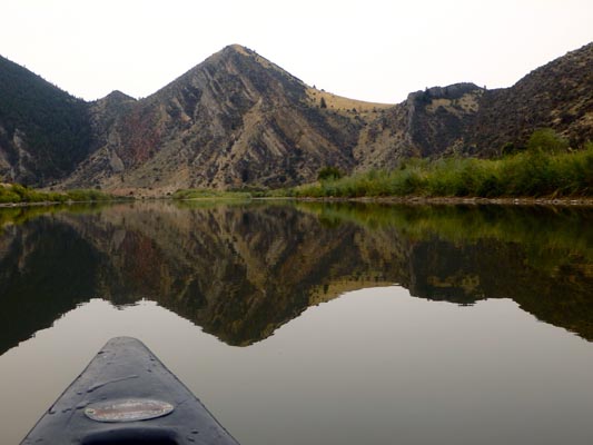 The Jefferson is a great river with incredible scenery, abundant wildlife, great floating opportunities, and an essential stake in our nation's history. Most land along the river is in private hands and development is encroaching everywhere. Yet amazingly, when you get into a canoe and experience the river from the viewpoint of Lewis and Clark, you discover how much the viewshed remains intact from the river. Most of the existing development is far enough back from the river that you only experience the cottonwood ecology along the river, against a backdrop of undeveloped mountains in the distance.
With the addition of strategically chosen backcountry campsites, floaters can take the Lewis and Clark experience from the water to the land, by camping and recreating in remote sites where the land seems nearly unchanged from 200 years ago.
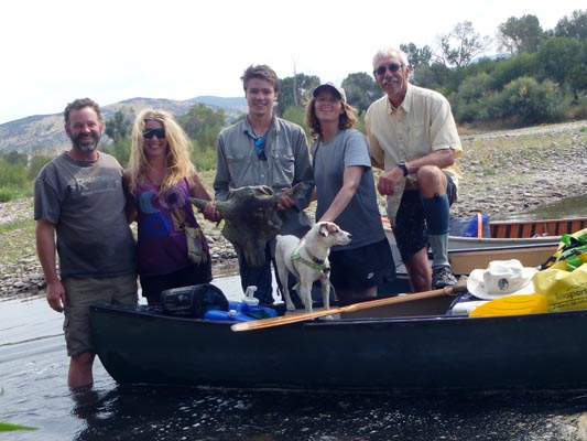 This kind of open space and open access has been a critical part of the Montana tradition throughout our history. People who grew up here were once accustomed to hiking, fishing, and hunting for miles and miles along rivers and through the woods, across public and private lands alike. But with increased immigration and development pressure, people find that they no longer have access to places they have always used, especially along the river corridors. Hope is not lost, however.
Our organization is working to make the Jefferson River corridor into something that people can more fully experience and appreciate. All that is needed is a few additional sites to allow floaters a quality place to get out and stretch their legs, have lunch, or stop and camp. Our solution is to acquire some backcountry campsites along the river that are accessible only by water, or if by land, then only by foot. We wish to avoid the maintenance problems and trash associated with roads and vehicles. Individuals who take the time for multi-day backcountry floats generally have a much greater conservation ethic, and are more likely to pick trash up than leave it.
 Camping is presently allowed at isolated parcels of BLM land along the Jefferson River, and within the ordinary high water mark, as allowed by the Montana Stream Access Law. Our organization has produced a unique set of river maps detailing where camping is allowed.
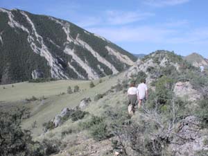
The grassy meadows and cottonwood groves are also part of the river experience, with the potential for camping, hiking, bird-watching, mushrooming, or fishing from the bank, but floaters have little access to it. Local Montanans, as well as history buffs following the Lewis and Clark trail, are denied the opportunity to fully experience the Jefferson River ecosystem. Those who decide to camp along the river anyway are encouraged to trespass onto neighboring private lands out of sheer necessity to find decent campsites.
The Jefferson River Canoe Trail is intended to provide river users the opportunity for a quality floating and camping experience without the need to trammel across private lands where they are not welcome. Campsites for the Canoe Trail are being chosen such that floaters will have a half or full day float in between each site. Our organization is working to establish campsites on suitable sites on existing federal and state lands, while purchasing land or negotiating recreation easements for additional campsites where necessary. Ownership of the land or easements will be placed with a nonprofit entity, while responsibility for site maintenance and management will be managed by us.
 Paddlers may follow the canoe trail with the aid of detailed conservation and recreation Canoe Trail Maps of the Jefferson River. Campsites are presently undeveloped, designated for no-trace backcountry camping, with guidelines for proper use printed on the Canoe Trail Maps. Volunteers will monitor use of the trail and evaluate the need over time for specific campsites, metal grills, or other needs.
It is our hope that the Jefferson River Canoe Trail will lead to greater public interest in sustaining not just the access, but also the quality of open space along the Jefferson River. We seek to work with landowners to secure conservation easements along the river in a way that will protect the natural character of the viewshed from the river, while helping to keep family farms intact and free from development.
Population growth trends in southwest Montana suggest that now is the time to make long-term decisions to sustain our traditions of open space and open access. The Jefferson River Canoe Trail is a significant step to preserve what remains and to guarantee recreational access to keep future generations of Montanans connected with the land and its history.
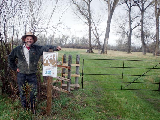 The Jefferson River Canoe Trail is a project of the Jefferson River Chapter of the Lewis & Clark Trail Heritage Foundation. We seek permanent solutions to sustain our traditions of open space and open access along the Jefferson River corridor. The organization takes a holistic perspective of conservation and recreation along the Jefferson, viewing the entire river system as a unified regional park. The Canoe Trail includes the entire length of the Jefferson along with the associated formal and informal fishing access sites, campsites, hiking trails, conservation easements, state lands and state parks, as well as adjacent BLM and Forest Service lands.
The task at hand is simply one of enhancing infrastructure to improve opportunities for traditional activities such as paddling, hiking, camping, bird watching, wildlife viewing, hunting, bicycling, horseback riding, mushroom hunting, and fishing. We seek to link sites on land and on water to better unite these parcels in a way that will sustain our traditions of open space and open access for future generations of Montanans.
Jefferson River Chapter LCTHF
PO Box 697
Pony, MT 59747
Contact Us
Become a Member
Join us today!
The Jefferson River Canoe Trail was mentioned in the
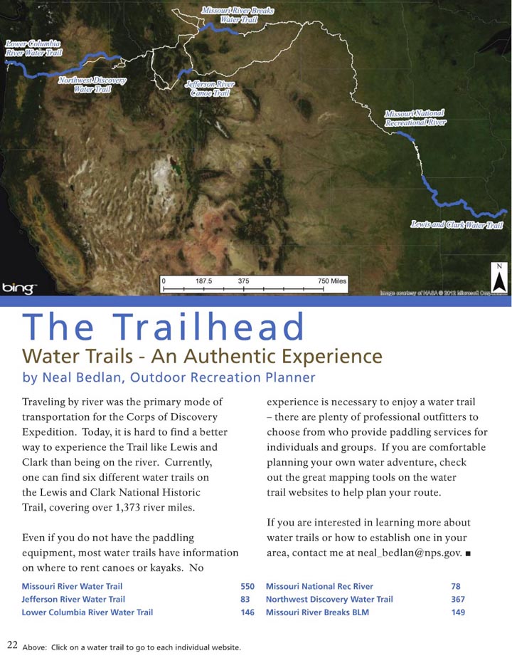
National Park Service Lewis & Clark newsletter-- The Trail Companion:

 Jefferson River Chapter Membership: Join us Today!
 The Jefferson is a great river with incredible scenery, abundant wildlife, great floating opportunities, and an essential stake in our nation's history. Most land along the river is in private hands and development is encroaching everywhere. Yet amazingly, when you get into a canoe and experience the river from the viewpoint of Lewis and Clark, you discover how much the viewshed remains intact from the river. Most of the existing development is far enough back from the river that you only experience the cottonwood ecology along the river, against a backdrop of undeveloped mountains in the distance.
  This kind of
  Camping is presently allowed at isolated parcels of BLM land along the Jefferson River, and within the ordinary high water mark, as allowed by the
  Paddlers may follow the canoe trail with the aid of detailed conservation and recreation
  The Jefferson River Canoe Trail is a project of the Jefferson River Chapter of the Lewis & Clark Trail Heritage Foundation. We seek permanent solutions to sustain our traditions of open space and open access along the Jefferson River corridor. The organization takes a holistic perspective of conservation and recreation along the Jefferson, viewing the entire river system as a unified regional park. The Canoe Trail includes the entire length of the Jefferson along with the associated formal and informal fishing access sites, campsites, hiking trails, conservation easements, state lands and state parks, as well as adjacent BLM and Forest Service lands.